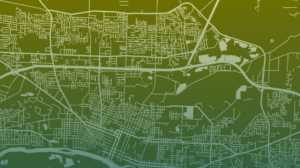
The City of Salem, Oregon, has shown dedication to achieving sustainability goals and revitalizing its neighborhoods by conducting walkability and comprehensive corridors assessments. As part of the Sustainable City Year Program, students from the Geography Department at the University of Oregon participated in an Advanced Geographic Information Systems (GIS) class in collaboration with Salem to uncover and address the deficits in pedestrian pathways and to strategize enhancements to the city’s walkable corridors. By leveraging the city’s geospatial data, the students crafted an array of network service area maps, density maps, and weighted overlay maps using ArcGIS technology. The analyses considered demographic distribution, the location of public amenities, urban zoning, and commuting behaviors to assess the feasibility of pedestrian navigation in Salem. Students focused on three main variables: diversity, equity, and inclusion; pedestrian safety; and sidewalk accessibility. In examination of these focal points, the data not only captures the current state of Salem’s pedestrian pathways but also aligns with broader community needs. The ensuing narrative will summarize our research into clear recommendations for improving walkability in Salem, providing an overview suitable for readers interested in actionable strategies.
Site Search:
Menu
Navigating Urban Networks: A GIS Exploration of Walkability in Salem, Oregon
Metrics
- University University of Oregon
- Sustainable Development Goals 03 Good Health and Well-Being, 09 Industry Innovation and Infrastructure, 10 Reduced Inequalities, 11 Sustainable Cities and Communities, 13 Climate Action
- University Department Geography
- Lead Local Gov / Community Partner Org Name City of Salem